Hillclimbs, nightlife and cruising: Enthusiasts flock to 102nd Laconia Motorcycle Week
Charles Michelson remembers his first time trying a drive up a steep hill on a motorbike, back when he was just a few feet tall and about the same age as his 8-year-old son is now.

You have to flip a lot of pages on the calendar to find the last time it didn’t rain on a Saturday
Something weird is going to happen Saturday: It won’t rain.
Most Read
 A Webster property was sold for unpaid taxes in 2021. Now, the former owner wants his money back
 ‘He died loving you’ — Jesse Sullivan sentenced in murder of half-brother Zackary
 Universal EFA program sees 2,000 applications in first week of expansion
 Webster seized and sold his house for back taxes. Now the town has agreed to pay him $38,000
 Company C is closing its Concord store – but the company itself isn’t closing
Editors Picks
 A Webster property was sold for unpaid taxes in 2021. Now, the former owner wants his money back
 Inside EFAs: How school vouchers have fueled a Christian school enrollment boom in New Hampshire
 City prepares to clear, clean longstanding encampments in Healy Park
 Productive or poisonous? Yearslong clubhouse fight ends with council approval
Sports

Athlete of the Week: Nate Kiah, Bow Falcons
Bow High School senior pitcher Nate Kiah had a stellar season on the mound and was a part of many deep playoff runs during his varsity career.
Opinion

Opinion: Outlines of a new dystopia
 Opinion: Speechless in America no more
 Opinion: Friends don’t let friends drive drunk
 Opinion: Concord should be run like a household, not a business

Your Daily Puzzles

An approachable redesign to a classic. Explore our "hints."

A quick daily flip. Finally, someone cracked the code on digital jigsaw puzzles.

Chess but with chaos: Every day is a unique, wacky board.

Word search but as a strategy game. Clearing the board feels really good.

Align the letters in just the right way to spell a word. And then more words.
Politics

New Hampshire school phone ban could be among strictest in the country
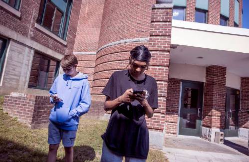
When Gov. Kelly Ayotte called on the state legislature to pass a school phone ban in January, the pivotal question wasn’t whether the widely popular policy would pass but how far it would go.
 Sununu decides he won’t run for Senate despite praise from Trump
Arts & Life

2025 Brodsky Prize for Excellence in Student Journalism awarded to Londonderry junior
In celebration of excellence and innovation in student journalism, the prestigious Brodsky Prize has announced its 2025 winners, spotlighting the state's most promising high school journalists.
 Concord Hospital Health System welcomes New England College nursing cohort
 High Range coming to Henniker Concert Series
 Young Professional of the Month Cady Hickman: Harmonizing Marketing, Marathons and Meaningful Moments
 Artist spotlight: Jackie Hanson
Obituaries
 Kevin Belliveau
Franklin, NH - FRANKLIN - Kevin Paul Belliveau, 64 died on June 16, 2025, after a period of declining health. Born in Franklin, NH on August 23, 1960, he was the son of Ernest and Lorraine (Gilman) Belliveau. Kevin attended St. Mar... remainder of obit for Kevin Belliveau
 Deborah Wheeler
Northfield, NH - Former State Representative, The Honorable Deborah Wheeler passed away peacefully on May 28th at the Hospice House in Concord with her loving husband of 13 years by her side. Born on May 17, 1945 in Northfield VT, Debor... remainder of obit for Deborah Wheeler
 Russell C. Rivard
Hill, NH - With profound sadness we announce the passing away of Russell C. Rivard , 71 on May 7, 2025 with his wife Derelyn by his side. He was a resident of Hill, NH for over 30 years and Quincy, MA. Russell was born, raised, and... remainder of obit for Russell C. Rivard
 Larry C. Owsowitz
Concord, NH - Larry C. Owsowitz died at hospice house in Concord on Tuesday, June 10 after a long battle with glioblastoma. Larry was born in Moses Lake, Washington on February 14, 1957. As an Air Force brat, Larry grew up moving from b... remainder of obit for Larry C. Owsowitz


 ‘The rug pulled out from under me’: For certain police and firefighters, last-minute changes to retirement deal breeds distrust
 Bell-to-bell school phone ban advances after budget deal
 Opinion: Juneteenth and the struggle for true freedom in Concord
 Making music: Contoocook-raised Derek Astles celebrates new album, old collaborations
 “ON/OFF The Wall”: A new collaborative art exhibit
 Officer testifies in murder trial that she never saw colleague place knee on psychiatric patient

 Track & field: Hopkinton’s Lane wins New England title in 3,200 meters, Concord’s Saysaw runs state record times in 100 and 200
 Boys’ Lacrosse: Bears narrowly lose to Plymouth in D-III championship, 7-5
 Boys’ volleyball: Coe-Brown wins program’s first championship, completes perfect season
 Baseball: John Stark falls in D-II championship to top-ranked Souhegan
 Opinion: Our leaders’ puzzling decision to eliminate the State Council on the Arts
 Concord became a Housing Champion. Now, state lawmakers could eliminate the funding.
 ‘A wild accusation’: House votes to nix Child Advocate after Rep. suggests legislative interference
  Town elections offer preview of citizenship voting rules being considered nationwide
